
Backers keep Boston’s South Bay Harbor Trail on track
By Jerry Guerra
Boston’s South Bay Harbor Trail (SBHT) is an ambitious, linear, recreation project that provides residents and visitors to the city with multiple quality-of-life benefits, including economic, transportation, health, social justice, and environmental. When complete, the 3.5-mile, shared-use path will connect five of the city’s diverse neighborhoods to the burgeoning Seaport District and revitalized Boston Harbor. It will also add a vital link to the “Emerald Necklace,” a 1,100-acre chain of green space connected by parkways and waterways designed in the 1860s by Frederick Law Olmsted.
Now, 20 years after then-Mayor Thomas Menino enthusiastically announced plans for the trail, construction continues. About 40 percent was available for use as of February 2021, another 25 percent is in or awaiting construction, and the remainder was folded into a larger roadway-reconstruction project, Melnea Cass Boulevard in the Roxbury neighborhood. Despite many obstacles, which span from right-of-way availability to logistical matters created by adjacent infrastructure, its backers persevere and the project advances.
For public officials and recreation advocates, the lasting lesson of SBHT is that no matter what it takes, a worthwhile project deserves to be built.
“Not much about this project is going to sound unfamiliar to anyone who has tried to build a linear, recreation project in an urban setting,” says Chris Mancini, Executive Director of Save the Harbor/Save the Bay (SH/SB), the non-profit group that set the wheels of the trail in motion. “It’s a classic case, where you’re dealing with dozens of stakeholders and a constantly changing landscape. On the face of it, it seems straightforward, but I’ve never seen a project like this take less than a decade to build.”
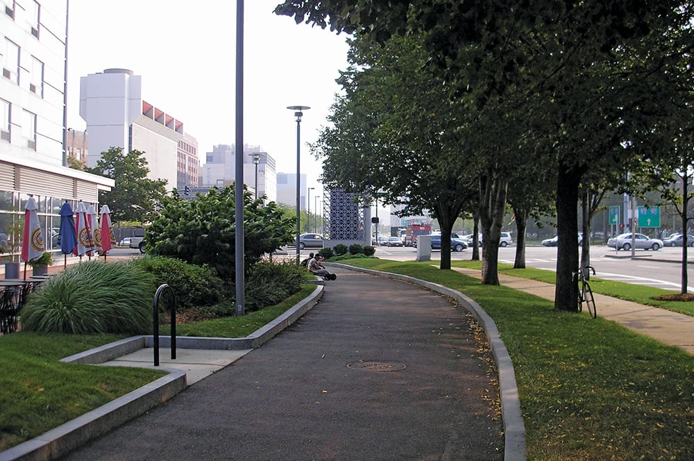
The SBHT is unique in many ways. The creative use of nautical themes for wayfinding, including decommissioned Coast Guard buoys, is a signature element. The trail also features a spectrum of vistas, including urban neighborhoods, imposing highway foundations, the city skyline, and the waterfront. Ultimately, the trail will play a role in making Boston more the place it aspires to be.
About The Trail
Save the Harbor/Save the Bay’s now-retired President Patricia Foley, working with architect and urban designer Michael Tyrrell, proposed the trail to Boston city officials in the early 2000s. Mayor Menino, who sadly did not live to see it completed, declared his support in an Earth Day ceremony in 2001, and praised the trail’s merits until his final days in office.
In addition to receiving some early pro bono design work from engineer Design Consultants, Inc.(DCI) and the late landscape architect William Pressley, SH/SB raised nearly $1 million to kickstart the design. This opened the door to an additional $3.9 million in federal and state funding for construction in the early stages.
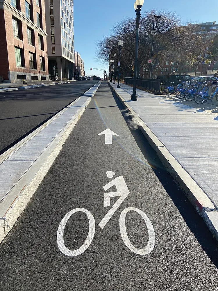
Beginning at the Ruggles Street Massachusetts Bay Transit Authority (MBTA) Station in Roxbury, the proposed trail will be a protected bicycle path along Melnea Cass Boulevard for approximately one mile before joining the Massachusetts Avenue Connector adjacent to the Southeast Expressway (Interstate 93).
“Our firm has been involved with the South Bay Harbor Trail from the start, and it’s a source of pride,” says David Giangrande, president of civil engineering, transportation consulting, and land surveying firm DCI, which merged with Connecticut-based GM2, Inc., in December 2020. Giangrande has personally participated in the planning, design, public outreach, and construction oversight of the trail from its inception.
“We’ve had more than our share of challenges,” says Giangrande. “But support never wavered from various departments in the city of Boston, MassDOT (Massachusetts Department of Transportation), Save the Harbor/Save the Bay, and many others. No matter what we ran up against, no one ever said, ‘This isn’t worth it.’ It was always ‘How can we fix this and keep moving forward?’ Many times it would have been easier to just give up, but the trail is that important to the people of this city.”
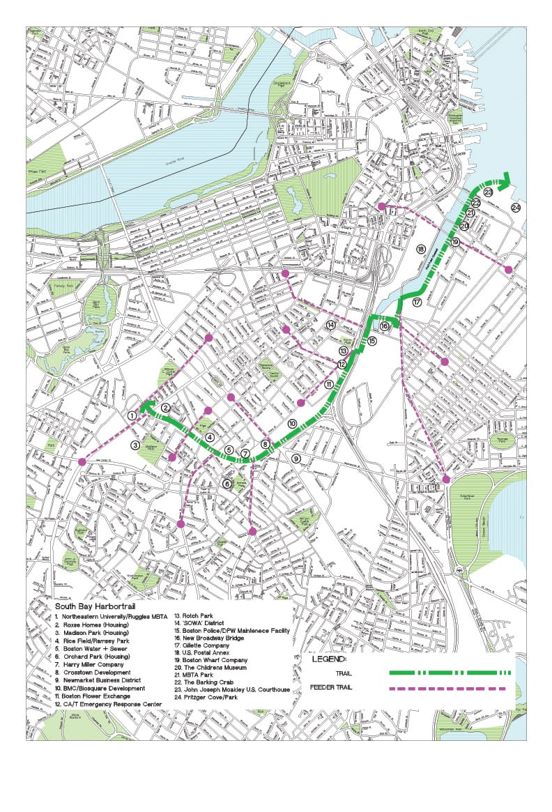
As the proposed trail approaches and runs alongside I-93, it encounters a less hospitable, more urban alignment. This incomplete section is crucial to the success of the entire trail, says Giangrande. “We’ve spent a lot of time on the section from the Mass Ave Connector to Albany Street, and we’re still working at it. It’s one of the most difficult pieces, but without this segment, the trail can’t connect from the neighborhoods to the Harbor.”
Adjacent to this piece, right-of-way constraints at two Albany Street parcels, along with an ever-changing development landscape in the area, have set the trail’s progress back. The Boston Planning & Development Agency, formerly the Boston Redevelopment Authority, is addressing the issue, developing a mobility-management plan to ensure multimodal equity and regain momentum for the trail segment.