
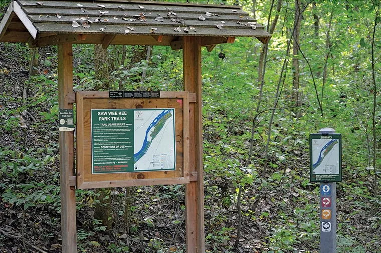
Wayfinding signage project cleans up safety and navigation concerns
Signage in Saw Wee Kee Park once consisted of an inaccurate map on a kiosk in the parking lot, and painted stripes on trees along the 11 miles of mountain-biking trails. This not only made the trails difficult to navigate, but local authorities expressed concerns if there was an emergency in the 134-acre park.
In the summer of 2021, the Oswegoland Park District initiated a wayfinding sign project at this regional destination located along the Fox River in Yorkville, Ill. The Sign Master Plan Project was part of larger improvements that included trail clean-up, updated emergency procedures, new signage, and new maintenance equipment. The park district partnered with the Oswego Fire Protection District (OFPD), Kendall County Sheriff’s Department, and Chicago Area Mountain Bikers (CAMBr) to create a new path-labeling system, location maps, and wayfinding signs.